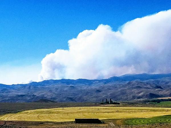
Like many in the West, our lives are defined by fire.
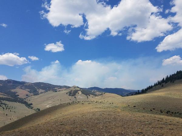
AUGUST 3: 1600 HOURS. There a massive column of smoke erupting from behind the Moose Creek ridge. I can see it from headquarters, even though the ridge is 15 miles away, and is a little obscured by the haze caused by distant wildfires in places like Redding. The kids and Caryl come out of the house and stand beside me as I stand with binoculars in stocking feet on the backyard lawn.
“What are you looking at, Dad?” asks 13 year old Maddie. Her voice is almost drowned out by a gust of wind that reached 40 miles an hour. The aspen trees in the yard bend under the pressure.
“Oh, just looking at stuff.”
I can feel the stare of Caryl beside me. I won’t make eye contact, and pretend to focus the binoculars. Caryl knows better. She, like I, used to fight fire in our younger days. We both wore the ash streaked yellow nomex shirts, jumper boots and hefted the heavy web gear. Maddie goes in the house.
“What’s going on?,” Caryl asks.
“Check out that column.” I pointed the way. “It is a little obscure in the smoky haze, but if you don’t look right at it, you can definitely make it out. It’s got to be a fire column.” I can see the sweep of it downwind, and pick out a point of origin. It’s 90 degrees, humidity is in the single digits, and the wind is whipping. Fire weather.
Caryl points out a second plume, a mile to the north of the big one.
Realization: from our vantage point, the smoke plume is bellowing ash exactly right behind cow camp, remotely situated in the high Moose and Park country on the mountain ridge 15 miles away from where we stand.
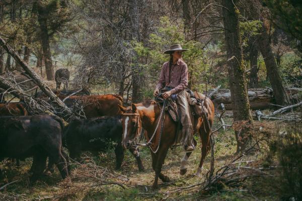
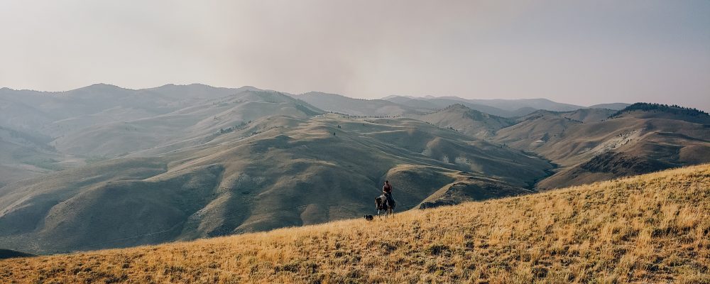
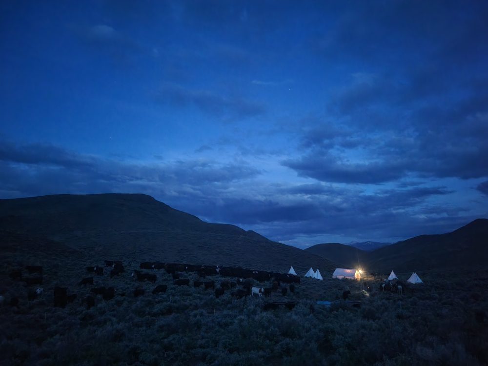
It was one of our range crew bosses, Anthony, that brought my attention to the possibility. Early this morning, I had sent Georgia and Sarah horseback to relieve the crew with a ride up the wild and remote Park Creek Canyon (the latest encounter there just the day before: a sow bear on the trail with two cubs feasting on wild gooseberries). It would take them about 5 or 6 hours to find and replace the current crew of Melanie, Josh and Linnaea up there in the Moose and Park country. The camp, Camp 7 for the summer, also known as Park Creek Camp, is the very remotest cow camp of the summer. There is no cell service, and just to drive the 2 track in, which Anthony was doing with supplies for nearly a week, could take as much as 3 hours.
He texted me from the only way in, an old logging road from the ’50s that he had been picking his 4 wheel drive route toward camp for nearly 2 hours: ” I see smoke near, over the ridge. Looks like it has begun recently. High winds. Going to continue heading in.”
I texted him back immediately, but he never responded. Cell service is unusual up in the jumble of peaks and canyons. He had to be cresting a ridge when he sent his last message.
I called the Forest Service. After getting through several layers, I finally got someone who would listen to my concern in the Salmon Interagency Fire Dispatch Center. “Dispatch. This is Jackie. How can I help you?”
“Hi. My name is Glenn Elzinga. I am a rancher with over 250 head of cattle grazing in the Hat Creek Country on the Salmon National Forest. I have 5 people spiked out there in a remote cow camp with my cattle. I’m watching this smoke on the horizon from my ranch, and am wondering if I need to be concerned.”
The nicely trained Fire Dispatcher’s voice, in an attempt at soothing a would-be angry citizen calmly stated: “I wouldn’t be alarmed, sir. We have those fires all documented and we have multiple resources deployed to contain them. We’ll be sure to let you know if there is cause for concern.”
“Do you have them located and shown on your Inciweb fire information internet platform?”
“Oh yes. We keep Inciweb updated immediately with new fire information developments. Please check that or Wildcat.net.”
I hung up, a little disgruntled, but figured I would be sated with abundant information, but ended up more frustrated than before. Wildcat.net didn’t exist. Inciweb didn’t have any information. No fires were showing up on their “real-time” mapping. I had people and cattle up there. And no easy way to extricate them or even notify them.
Next step: go to the top. I got the Forest Service District Ranger, Ken Gebhardt, by miraculously finding his cell phone number. He was in charge of the whole zone, and was great. He understood and validated my concerns. Indeed, I wasn’t delusional: “What you’re seeing is the Rabbit’s Foot fire. Based on my estimation from my maps, your crew and cattle are over 9.5 miles away, and are not downwind.” In addition, he stated that I had several topographic features such as bare granite peaks and deep canyons between the fire and camp. I breathed a measured sigh of relief.
“But I would advise you, Glenn, to head up to the area to see it for yourself.” Good advice.
AUGUST 3: 1730 HOURS. Caryl and I jump in the truck and head up Morgan Creek; it is the remote valley that separates our Hat Creek range from the Idaho Primitive Area, or Wilderness. It’s the last road on this side of Idaho, and was the only way we could see Rabbit’s Foot firsthand, and make an assessment. As we drive into the late afternoon sun, much of the sky was obliterated by the wind whipped column. The fire was in full “blow-up” mode by now, and the smoke column rises to more than 15,000 feet skyward.
A rosaceous glow bathes the foothills up Morgan Creek as we drive up the long canyon. It’s about an hour away from the ranch, and as we come around a bend nearing the first view of the fire landscape, we are disappointed to see that the Forest Service has the road blocked.
A sunglassed man dressed in clean yellow nomex puts his hand in the air, halting our progress. I pull up, and roll down the window, as I read his name tag rectilinearly arranged above his left front pocket. Benjamin Smith. I take note. “I have been instructed to let no one pass this point, except grazing permittees and riders.”
“I’m a grazing permittee.”
“In Morgan Creek?”
“No sir. I am in Hat Creek.”
“Then I can’t let you pass.”
“Listen. I have over 250 head of cattle and 5 people just over that ridge, up there, and I need to make an assessment as to whether or not we evacuate.” I pointed to the ridge, and turned back to face his dark sunglasses (a pet peeve of mine, mind you). “I was instructed by Ken Gebhardt, District Ranger, personally, to make my own assessment on the ground.”
That got his attention. “What is your name, sir?”
“Glenn Elzinga.”
He reached for his radio with the long wiggling antenna, stepped back from my window, and said “Could you wait here for a moment, sir?”
I nodded. And waited. He began to speak into the radio. “Annie Rooney Helibase, this is Van Horn Checkpoint. Do you copy?”
 As he spoke into the radio, a beat up, crap-bomb Ford Ranger pickup rolled up. Four Australian Shepherds looked out of the open bed. Two more little pups peered out of the driver’s side window under a torn shirted arm. It was Colt Jenkins, rider for the Morgan Creek Allotment.
Perfect. I told Caryl my quickly hatched plan. She nodded. I trotted over to Colt’s pickup.
“Hey pardner. Mind if I throw in with you? This gent (I pointed to the Forest Service nomex road blockade man) won’t let me through. But he can’t stop me if I jump in with you.”
“Of course, Pard. Get in.” I scraped the horseshoe tools, wrenches, and vet medicine off the front seat, pushed the Aussie pups to the middle (they were eager to visit) and promptly spilled an open can of Bud on the floor. I couldn’t see it under the dirty t-shirt it was hidden under.
“Dang it, Colt. Sorry about that.” I put the can upright. “It ain’t all gone; there’s still a hit or two left.”
“You’re good, pard. No worries.” He smiled and pressed the clutch, slipped the Ranger in gear, and off we went. Aussie dogs spilled into my lap. New territory. New scents.
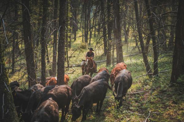
Colt and I talked dogs, cow camps (he too, was camped out all summer) and people we knew, and places we’ve rode. He’d just moved 70 cow calf pairs out of harm’s way. Now, the fire had split the herd, with about 400 head to the North and 600 head to the South. Their range was a sight bigger than ours, with nearly 130 square miles of ground to cover.
“Now, the dangdest thing is that to get to the North part of the herd we gotta go around.” I knew what around was. It was about a two and a half hour drive.
The fire column boiled up immensely before us. We begin to pass fire personnel. They were dirty. Their bright yellow Nomex shirts were mostly charcoal. They are walking through the few remote log cabins that occasion Morgan Creek Road. “We’re doing structural assessment inventory,” says one that we stop and chat with. Even his teeth are dirty. The billowing gray clouds obscure the ridges I want to see, and I can’t tell exactly where the fire is.
“Let’s go back, Colt. I’m not going to see what I wanted to.”
“Okay, Pard.” He throws the truck into a U-turn on the narrow road. The pups roll off of me to the other side of the cab into Colt’s lap. He smiles with eyes forward on the road. He likes them.
I try to talk him out of a dog on the way back, but he won’t budge.
AUGUST 3: 1930 HOURS. I arrive back at the Van Horn Checkpoint. Benjamin Smith is still manning it. I reflect on how clean his Nomex looks compared with the crews up the road. His name tag is still straight. He approaches me as I get out of Colt’s truck.
“Thanks again, Colt. Good luck to you.”
“No problem, Pard.” The pups gather under his torn sleeve, heads mashed against the top of the rolled down window. They wag their tails. The faded blue paint of the Ranger is turning a shade of purple now, in the rosy glow of the smoke filtered sun. He drives off in a rattlebang cloud of dust. The muffler is all but gone.
I turn to Benjamin. “What do you have, Ben?”
“The operations chief of the fire wants to speak to you. He is in a helicopter doing aerial reconnaissance, and will be landing at Annie Rooney meadows shortly. Can you wait?”
I look at Caryl, check her eyes, and say, “You bet. We’ll wait.”
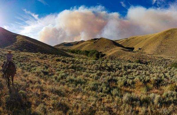
Twenty minutes later, we see a Jet Ranger helicopter emerge from the smoke up the valley, and make an approach to land in the canyon to the North. A few minutes later, we can hear Ben’s radio crackle to life. After conversing on it, he comes back to us in our truck.
“You are good to go, sir. Head up the valley until you reach the Annie Rooney Helibase. There, your contact is Bill Pierson, Chief of Fire Operations. He will provide you with the most recent information.”
I reach out my hand. “Thanks so much, Ben.” We shake.
“I really appreciate this.”
We drive North, up the valley, now given rite of passage. We feel privilege, as we observed several people being turned away as we waited. In several miles, we enter thick forests, now shaded by the lack of sunlight from a setting sun. We break into a big meadow. I remember years ago that Cowboy Tim and I gathered cows here one late October surrounded by the gold of turning Aspens.
A long row of heavy backcountry fire trucks occupied the shoulder on the left. There was only room for one vehicle; at the end of it, a Nomexed man with a white helmet gestured to me. As I drove up, I recognized the name on the frontspiece of his hat: Bill Pierson.
I pulled up, and got out, and grabbed his hand. “Hi Bill. Glenn Elzinga.”
“Hi Glenn. Was hoping I could spend a minute with you.” He pointed up to the fire. “I just got out of a helicopter, and, let me tell you, we got our asses kicked up there. That wind is coming from everywhere, and is completely unpredictable.” He looked back at me. “So where are your cows? You got people spiked out up there, too?”
I filled Bill in, and showed him on his phone app where my camp was. He showed me where the fire was most proximal to our camp, and told me the landmark for me to find on Google Earth to estimate mileage for the fire to reach it.
Bill went on: “Here’s the deal, Glenn. With these winds and incredible fuel loading in our terrain here, and your proximity to the fire, I must advise you to move your people and cattle.” He didn’t have sunglasses on. He was looking me right in the eye. “You know, we simply have no resources to do anything with this fire behavior. There are plenty other places in the West that demand more people, more equipment than this; there are people dying there. Homes are burning. We simply can’t do anything for you. I advise you to move.”
AUGUST 4: 0530 HOURS. I get on my pc and bring up Google Earth. Inciweb actually is now updated with the Latitude and Longitude of Rabbit’s Foot’s starting point, a lightning strike that occurred on Wednesday. I copy and paste the data to Earth, and have an immediate location of the ignition point of the fire. Using the Ruler function, I measure the distance to Cow Camp: 9.5 miles. Then, I locate the point that Bill Pierson related to me, and re-measure the distance to camp: 5.3 miles. The fire had run 4.2 miles toward camp in one day.
I checked the weather forecast. Despite a slight cooling trend, winds were to shift to originating from the NW by Sunday. That put camp perfectly downwind. Then, by midweek, in 4 days, temps were to rise to the 90s, the perfect recipe for intense fire behavior.
The last thing I checked on Inciweb was the estimated fire containment date for Rabbit’s Foot: October 21, at noon. In other words, they were planning that God would put this fire out with snow.
It was all I needed. I had to notify the crew immediately. By dirt bike was the fastest way. I grabbed my pack, put on my overcoat for the chilly 42 degree air, and headed up to the bunkhouse to tell the ranch crew their part. We would evacuate camp. And so, I left to reach my remote range crew by motorbike. Little did I know how many miles I would go.
AUGUST 4: 1900 HOURS.
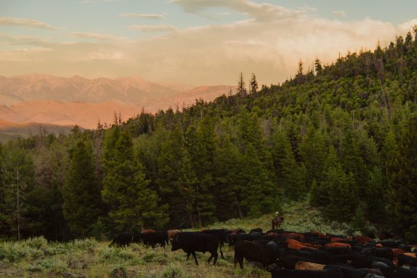
Despite it being later in the day, I still have the crew moving the cattle as I write this. I just got back from covering nearly 200 miles on the dirt bike, coordinating all the riders as we gather. There were things on the home ranch that needed attention; animals needed water. Renae pulled all personal and critical gear from camp. If we can, we’ll go back up there and get the rest. We have no idea where the fire is or where it is going, but we have a plan: we have plenty of grass in lower elevation Little Hat Ranch, and here at home.
Thanks for reading this. I feel like so many of you are friends, partners in what we do, and I somehow owe it to you to keep you posted. I think things are well here, now, and I am grateful for the ability to choose a place where we will be safe, I think.
Some have not been so fortunate. We think of folks in Redding, CA, and many other places in the West where fire has dealt them the worst of hands. For them and their loved ones, we pray and wish our best.
Since they are all out of reach from cell service, it is time that I head out again to find the hands and horses on the range. Somebody has to get them home with a trailer ride for horse and rider, and it has to be me, hopefully before cover of darkness. Have a great weekend, everybody, and Happy Trails.
Glenn, Caryl, Girls and Cowhands at Alderspring



Leave a Reply