Without a word, the bush guide, Jack, gestured to us to come with him to the dust-crusted large side window of our packed gear van. He reached up, torn flannel plaid sleeve waving, and his grease impregnated index finger began to etch a jagged line that would span the glass. The line in the dirt: a river, called the Babine. The window: a map.
I nervously eyed the gray British Columbia sky. Moss hanging from trees, as in a rainforest, flagged in the wind, like telltales on a ship’s rigging. Moisture filled the air, and the towering snow streaked peaks above us were shrouded in fog. Even though it was August, it felt like it could snow anytime.
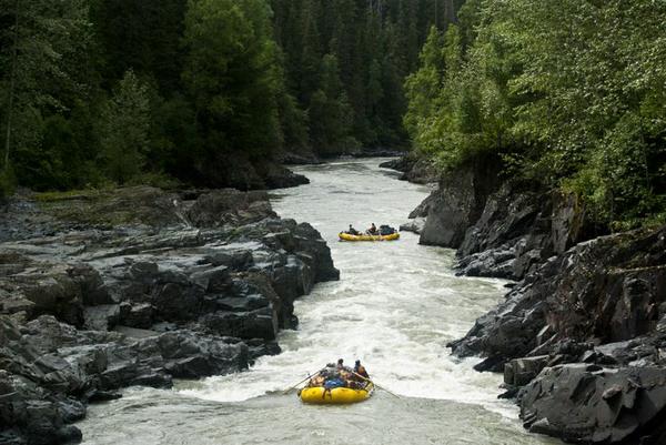
As he made tick marks along the line, he needed confirmation once more. “Are you sure you’re not outfitters?” he asked in his British Columbia bush brogue, still turned toward the window, as his finger continued to draw. He stopped working on his masterpiece and turned to see us collectively shaking our heads slowly.
I spoke. “No. We aren’t. We just saw this river on the map and couldn’t get any better information than you’re giving us here. The people around here in the bush said to come to you. They said you would know.” It had been a quest just finding this man Jack. We piloted our intrepid van through miles of bush logging roads to find his cabin in the middle of the BC wilds.
It was a day 30 years ago, back in the dark ages before MapQuest, Google and cell phone pictures. Paper maps in plastic bags were the thing in the rainy forest of BC, and ours lacked the detail we had hoped for. We had driven for 2 days to get to this river with our whitewater rafts, gear and 4 couples. It seemed like a good idea at the time when we consulted maps on sunny days in the university library back in Montana.
Now, I wasn’t so sure.
Jack finished and started identifying the places to watch for on this roadless, wild and dangerous river. Indeed, he was our man, as he had descended it at least a dozen times, and it was clear that it had become a part of his livelihood—taking clients down the forbidden canyons of Babine. “This here’s what I call Grizzly Drop.” He pointed to one of his hatch marks along the jagged line of river that represented almost 100 miles.
“The entire river narrows into a waterfall about 12 feet wide. The drop is not huge—only a 4-or 5 feet, but there is a keeper hole at the bottom that eats boats. I’ve run it, and survived, but not sure you’ll want to.” He eyed us all carefully, as if seeing if we were tough or experienced enough or both to pull this trip off. “If you do, scout it. But be careful. The sound of the falls is enough that you can easily startle one of the grizzlies that grab salmon out of the water there.”
Our friend finished his map in dust as drops of rain began to fall. We hastily grabbed a sheet of scrap paper from the van and copied his map. It would be our lifeline over the next 5 days, giving us needed info for safe passage through glacier-fed continuous whitewater and densely populated grizzly country. He noted rapids to scout, places to camp, and canyons to run. If anything went wrong, we were on our own. There were no roads, no satellite or cell phones. We needed his map. He made it clear that it was very unlikely that we would see anyone else. Anywhere.
In a sense, it was Jack’s river.
Thick drops of rain began to fall as we hastily shook hands with him and thanked him for his information. We boarded our stuffed-with-gear van like sardines packed up in a can. Lee was at the wheel, and I at shotgun, so I watched Jack in the rain-streaked rearview mirror as we pulled away. The river guide watched us, stoic and unmoving as we pulled out. I watched him, watching us, until a curve in the logging road obliterated him from view. I wondered what he thought. Were we crazy? Suicide bound?
We found the bush roads as he described them. After hours of night driving on muddy two tracked roads in the thick forest, the road ended in a wide spot along a river with a broad and low waterfall in it. It was our river, and by headlight and flashlight beam we confirmed it to be just as Jack said it would be. We lit a lantern and proceeded to set up tents as the rain fell harder. We threw up a tarp, using the van to prop up one side of it, and made a hasty midnight dinner over the Coleman stove. The excitement of a new river to explore was still in the team, but it was certainly extinguished to some degree by a wet and cold fatigue.
As Caryl and I finally got into our damp bags in the tent, we could hear a rhythmic splashing in the water in the river, just 50 feet away in the dark. I joked with her as we dozed: “Hear that sound? That’s the sound of hundreds of salmon trying to make it up over that waterfall.” We both laughed and fell fast asleep with anticipation of what the next day would bring. The river soon lulled us to a deep sleep.
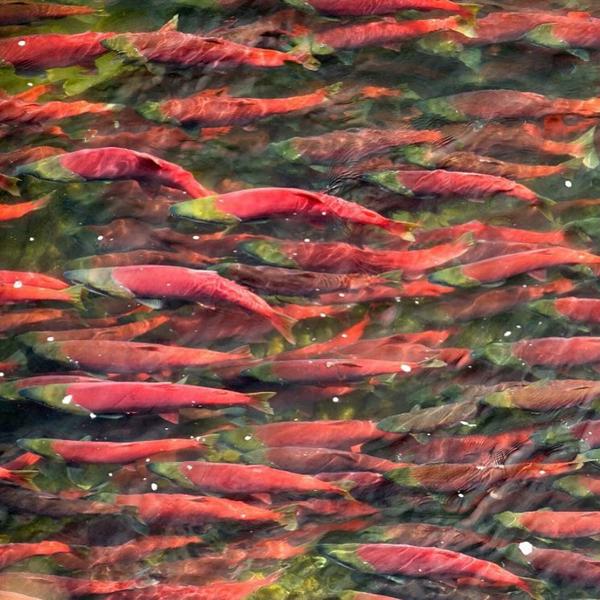
The next day dawned partly cloudy. The rain had stopped. I emerged from our tent first, and one of our companions, Jim, was along the bank of the river. He heard me get up and beckoned me to come over to the river. It was a beautiful river, quite clear, and in this spot fairly placid but a fast-moving ribbon of blue with the rock flour that betrayed the existence of glaciers at its source. It was over 50 yards wide, and as I got closer, I noticed there was a peculiar red color to the water.
It was the reason Jim, a federal agency fish biologist by trade, gestured to me to come. The red color was due to thousands of salmon in the water, staging to jump up the small waterfall. The thing Caryl and I laughed about the night before wasn’t a joke. It was true. The river was literally choked with fish trying to make it over the falls.
We were nearly 300 miles above the river’s outlet into the Pacific. There were many rapids they encountered on the way here, after 2-3 years ocean bound. We were going downstream, wondering if we would survive without wreckage while ripping down the gravity spawned torrent of white. They had a much more arduous voyage, up those falls, past hungry bears, always against a relentless current.
I waded into the river of red. They parted as I walked through them in the shallows; it seemed a four-foot distance made them comfortable. They were fat. There were mostly silvers, some Sockeyes or red salmon, and some kings, some over 3 feet long. They had feasted on plankton, krill and small fish during their oceanic stay. They had travelled nearly 3000 miles in the open ocean, a place of featureless deep and dark water. No island chains perforated the blank blue screen of the great ocean on its northern tier.
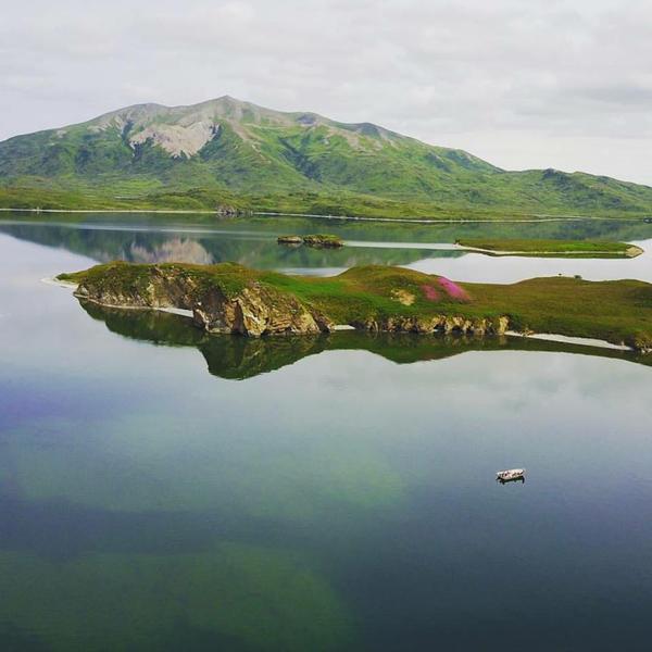
And then it hit me. We met them here, with a quite primitive map on the side of a van. Actually, the van map only lasted for about half the journey into the backcountry. We needed the paper towel edition to finally arrive. They obviously had neither map nor Jack to tell them anything. So how did they manage to get back to what is basically their birthplace? What provided navigation for them?
Back in Idaho, Jim and his compatriots in fish biology had told me that it was smell that brought them back to the high Pahsimeroi Valley, where Alderspring Ranch finds its home. It’s how those great Chinook (our version of King) salmon make it up the 900 miles up the Columbia, Snake, and Salmon rivers and back to the mouth of the Pahsimeroi River, then to their hatching grounds here on the ranch, making the right choices at hundreds of river forks along the way. But now the bigger question nagged at me. How did they find the mouth of the Columbia out of 4 million square miles (really, conservatively speaking) of featureless ocean?
Surely, the smell of the Pahsimeroi or Babine couldn’t be a guiding force for a fish out in a salt water ocean 3000 miles from home. Talk about dilution. And all of these fish, now at my feet in the swirling and icy Babine had some kind of navigation code or device in their being, in their marble sized brain, that we humans had not yet cracked. Little did I know at that time, in 1987, that it wouldn’t be figured out until 26 years later.
It was 2013 when Nathan Putman of Oregon State University made the connection after examining over 56 years of fish migration data in the Fraser River of British Columbia. He announced his findings in February 7, 2013 issue of Current Biology. “To find their way back home across thousands of kilometers of ocean, salmon imprint on the magnetic field that exists where they first enter the sea as juveniles,” he said. “Upon reaching maturity, they seek the coastal location with the same magnetic field.”
This is not the equivalent of having a compass on board their brain. This is more like an ability to photograph the Earth’s magnetic field in their brain at the time they hit salt water. It’s akin to you looking at the light pole number you parked near at the mall when you went Christmas shopping. Let’s just say you come out of the wrong exit at the shopping mall. You remember that you parked near pole 43. You find yourself at pole 33. You know you have to walk in the direction that yields increasing numbers on the light poles until you get to pole number 43.
It is the same with the salmon. They can compare the current magnetic field configuration of their mid-ocean location with their home river, where it joins salt water. As the configuration trends closer to that of home, they have confirmation in their direction of travel, and they continue in that direction.
Eventually, they find the match with their original imprint, and they swim into the river mouth, where scent augments the magnetic field information. That’s how it works with wild salmon. Hatchery raised fish are a different story. Here, it gets a little more complicated.
It’s because those juvenile hatchery salmon are often exposed to electromagnetic fields caused by technology such as lights, electric fences, and wiring during their upbringing that are much stronger than that of the Earth’s magnetic field. And that poses a problem when juvenile salmon imprint on this confusing information. This phenomenon causes many hatchery fish to “get lost” in the ocean. They may return to other rivers, or never return to a river to spawn.
Hatcheries can cause more problems for fish and fisheries. In fact, many of so called Alaskan “wild” salmon spent a good part of their first year in a hatchery in the Gulf of Alaska (the Sockeye we sold for the past few years from the Maxcys of Cordova is an exception: less than three percent of those are thought to be hatchery origin, but some other “wild” salmon species in the Gulf of AK are thought to be as high as sixty percent hatchery origin) The inferences are obvious; they are essentially an early life farmed fish. It’s not known yet whether their early life habitat in their concrete feeding ponds has an effect on their nutritional benefits to us humans, but I know what I’d rather eat.
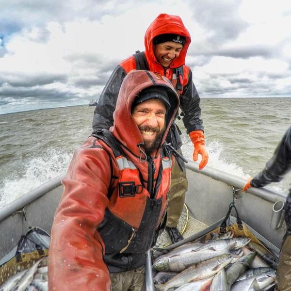
So that was an issue for us when we chose our new salmon purveyor, after the Maxcys notified us that they couldn’t supply us any longer. And now here we are, across the Alaskan peninsula into Bristol Bay, partnering with Traveler Terpening, a small scale artisanal fisherman in the largest completely wild Sockeye salmon fishery in the world. It is hatchery-less. And his Sockeye is amazing, although Caryl said she can taste differences, a good thing that reflects differences of place.
The intrepid river explorers that Caryl and I once were survived the Babine, obviously, despite almost dying from rockfall, exposure and having a wreck in big water that nearly destroyed one of our boats and resulted in lost gear (the trip was a journey in humility). At least we didn’t get consumed by grizzlies. They had plenty to eat in the form of fresh salmon, so they really had little interest in us as we were wearing our lifejackets and wetsuit gear (sometimes it’s just the label, you know, that causes an eater to pass on a food).
I don’t know if the fish still run there as they did then; I’m afraid they do not. Just in the past 20 years, huge fish farms have taken up residence over much of the Canadian coastline, and unfortunately have contaminated native salmon stocks with disease and non-wild genetic material. Most likely, 30 years ago, we were witnessing the last days of the wild Babine, at least with regards to salmon.
And so, wild protein continues on its steep decline worldwide. Wild is fragile, especially when exposed to the reductionist interventionism that defines much of humanity. Too often, Homo sapiens fails to see consequence, and wild is lost. It may be recreated, but intentionally. We had to recreate it with our beeves on wild landscapes, instead of simply finishing our cattle on a grass farm.
Unfortunately, the way is not always clear; it’s kind of like writing on the van window when the drops of rain are starting to fall. We found fishermen like the Maxcys and now Traveler, with salmon. They were and are a good fit. We’ll stay on task, even if we have to map it out in uncharted territory. Thanks for partnering with us on the quest for wild flavor and nutrition density.
Happy Trails
Glenn, Caryl, Girls and Cowboys at Alderspring



Leave a Reply